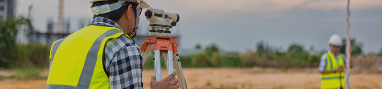
8 Ways GIS Helps Predict and Prevent Tsunami Disasters
On December 26, 2004, a massive earthquake struck beneath the Indian Ocean and sent a wall of water nearly 100 feet high outward. It barreled into South Asia at 30 miles an hour, wiping out communities before most people even knew what was coming.
By the time the waves crossed the ocean, nearly 230,000 lives had been lost, making it one of the deadliest disasters in modern history.
We can’t stop tsunamis from forming. But today, we’re far better prepared. Thanks to GIS technology, scientists can spot danger sooner, issue faster warnings, and save more lives. Let’s look at eight ways GIS technology makes that possible.
What Are Tsunamis?
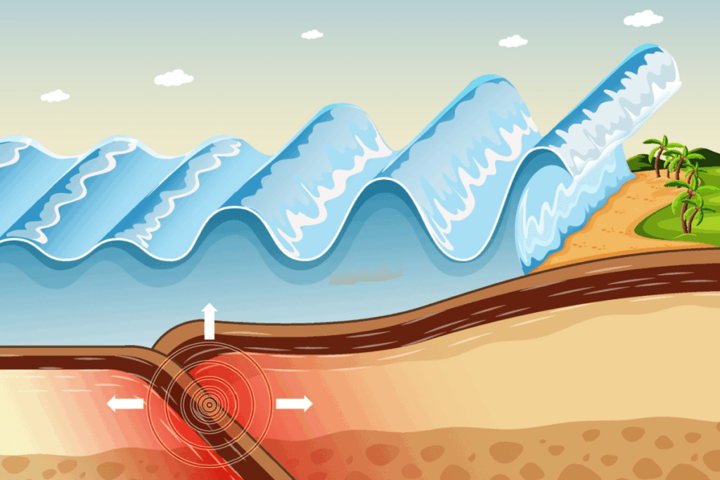
Tsunami means “harbor wave” in Japanese, but it’s not an ordinary ocean wave. A tsunami is an entire water column—from the seafloor to the surface—that moves at speeds up to 500 miles an hour. (That’s as fast as a commercial jetliner.)
Tsunamis are triggered by sudden, large-scale disturbances in the ocean, like:
Undersea earthquakes
Volcanic eruptions
Underwater or coastal landslides
Tsunamis are dangerously deceptive. If you’re at sea, you may only feel a slight bump or dip as the monster passes beneath. But as a tsunami approaches shallower waters, it slows down, grows taller, and becomes a destructive surge.
Can Tsunamis Be Predicted?
While tsunami prevention is impossible, tsunami prediction has greatly improved in the last two decades. Before GIS technology, early tsunami prediction systems centered on the Pacific Ocean. In other areas of the world, technology and resources were limited, and predictions were often crude and uncertain.
A survivor of 2004’s Indian Ocean tsunami later described hearing what sounded like roaring thunder. It was so loud that hotel staff and guests thought a plane had crashed offshore. Moments later, a dark wall of water came rushing in.
How GIS Improves Tsunami Prediction and Preparedness
Think of GIS as the brains behind tsunami preparedness. It can’t stop earthquakes, but it buys time, saves lives, and helps communities make critical decisions long before waves reach shore.
Let’s explore eight ways GIS protects coastal communities from tsunamis.
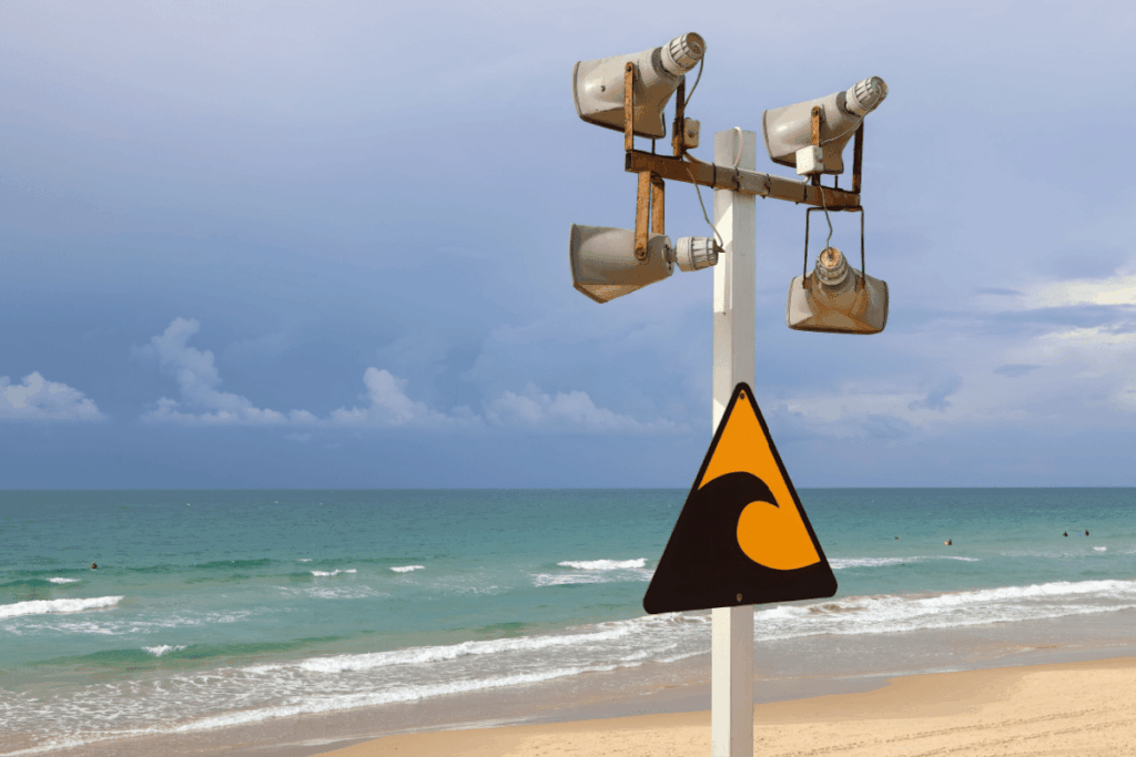
1. Integrating Early-Warning Systems
After the 2004 Indian Ocean disaster, scientists used GIS to connect several separate monitoring systems into a powerful,real-time tsunami warning system. These included:
Seismic networks
Ocean buoys
Tide gauges
Coastal sensors
When a major earthquake occurs, GIS quickly determines whether a tsunami is likely and which coastlines are at risk. This critical information makes rapid alerts and evacuations possible.
In 2011, a massive tsunami struck Japan. While the losses were devastating, Japan’s GIS-based early warning system helped reduce impacts and has continued to improve since.
2. Identifying Who’s Most at Risk—and Where
Japan’s tsunami warning siren has a nickname: the “5 p.m. chime,” because it gets tested every weekday at five in the afternoon. Like the American Emergency Alert System, Japan’s siren is crucial both for real scenarios and for educating vulnerable populations.
GIS technology helps scientists layer population data and determine tsunami flood zones. The government then prioritizes siren coverage and evacuation planning for vulnerable areas.
3. Real-Time Mapping for Emergency Response
What happens when a tsunami is confirmed? GIS-powered emergency warning centers get updates in near-real time, displaying:
Warning zones
Predicted arrival times
Estimated wave heights
Incoming damage reports
Real-time mapping systems help officials coordinate evacuations, close transportation corridors and deploy emergency crews while the first wave is still en route.
4. Modeling “What If?” Tsunami Scenarios
How are tsunamis predicted? Scientists at NOAA’s Center for Tsunami Research pre-compute thousands of tsunami scenarios—including different earthquake sizes, locations, and fault movements—and store them in GIS. This allows them to run models and predict potential impacts before disaster strikes.
Determine where hillside shelters or vertical evacuation towers are needed
This planning can mean the difference between life and death when every second counts.
6. Planning Safer Coastlines
Ever heard of “the Big One”? A giant fault line running from California to British Columbia could rupture and cause a massive tsunami. The U.S. Pacific Northwest is planning urban projects with this worst-case scenario in mind.
This includes:
Avoiding building in the most dangerous zones
Strengthening critical infrastructure that must stay near the coast
Updating zoning rules and building standards
7. Making Maps Public and Accessible
Accessibility can save lives. Scientists use GIS to turn data into simple visuals for citizens. For example, if you’re in Hawaii or Alaska, you can use a tsunami evacuation map to know your zone, where to go, and how to get there quickly.
These maps are used in school programs and evacuation drills, so community members are equipped with a clear plan before a warning siren ever sounds.
8. Partnering GIS With AI Algorithms
Can AI predict tsunamis? Not in advance … yet. Earthquakes happen too suddenly. But AI is already used in GIS-powered systems like the U.S. Geological Survey’s ShakeAlert and the Japan Meteorological Agency’s warning system. These systems quickly classify earthquakes, helping improve GIS-based hazard models.
Key Takeaways
Need a recap? Here’s what we know about using GIS in tsunami-prone areas:
GIS technology can’t stop tsunamis, but it buys time and saves lives.
Integrated data enables faster warnings and evacuations.
Real-time maps guide emergency response.
Scenario modeling improves preparedness.
Population and public maps reduce confusion.
AI enhances forecasting as a supplement to physical models.
Want to Be on the Front Lines of Disaster Prediction?
Our fully online, career-focused program helps you apply your interest in extreme events to real-world challenges across fields such as:
Disaster preparedness
Biology and environmental science
Law enforcement
Sociology
Social media
The future belongs to people who can see patterns before they unfold. See what UTPB’s GIS and Geospatial Graduate Certificate is all about and where it can take you next.
On December 26, 2004, a massive earthquake struck beneath the Indian Ocean and sent a wall of water nearly 100 feet high outward. It barreled into South Asia at 30 miles an hour, wiping out communities before most people even knew what was coming. By the time the waves crossed the ocean, nearly 230,000 lives had…
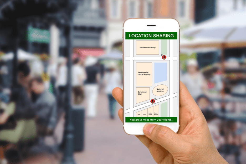
Imagine you’re commuting to work and your Google Maps loses signal. Suddenly, the little blue dot stops moving and you don’t know where you are. Panic ensues (for some of us). Modern devices constantly broadcast our location through GPS, Wi-Fi, cell towers, and apps. We’re basically walking beacons of sensitive data. But here’s the flip side:…
Flu season is here again, with all its aches, pains, and fevers. But scientists have a powerful tool to fight back. The GPS technology used to plot your rush-hour route home? It also powers GIS (Geosciences Information System) tools that help public health officials pinpoint infectious disease outbreaks, limit their spread, and spot gaps in…
Imagine you’re commuting to work and your Google Maps loses signal. Suddenly, the little blue dot stops moving and you don’t know where you are. Panic ensues (for some of us).
Modern devices constantly broadcast our location through GPS, Wi-Fi, cell towers, and apps. We’re basically walking beacons of sensitive data. But here’s the flip side: While geolocation is extremely helpful, it also risks surveillance, data breaches, and misuse of location data.
In this article, we’ll explore how geospatial data works on your devices and what you can do to protect yourself.
What Is Geospatial Data?
Geospatial data is any information that tells you where something is on Earth. This can be a map, your phone’s GPS coordinates, satellite images, or even a spreadsheet that lists all the coffee shops and pet stores in your city.
Examples include:
Satellite imagery and aerial photography
Maps of roads, rivers, or utility networks
Demographic or environmental datasets tied to coordinates
Real-time tracking data from mobile devices or sensors
Your location at any point is called your geolocation.
How to Hide Your Location
Protecting your location doesn’t mean going off the grid completely. You can take several practical steps to control who sees your data and when.
Here are five effective methods:
#1 Use a Virtual Private Network (VPN)
VPNs work like a disguise for your device, creating an encrypted tunnel to a remote server. They mask your real IP address, so websites and online services see the VPN server’s location instead of yours. If your VPN is in Croatia while you’re in the United States … it appears you’re browsing in Croatia.
#2 Spoof Your Location With a Proxy
A web or browser-based proxy acts like a middleman between you and the internet.
When you visit a website through a proxy, your request doesn’t go straight to that site’s server. It first passes through the proxy server. That means the website only sees the proxy’s IP address, not yours. Many proxies appear as regular HTTP links. Unlike VPNs, though, they generally lack encryption.
#3 Disable Sensors and Services
Your mobile phone tracks your location and collects geodata everywhere you go. One way to hide your location is to simply turn off location sensing. Turning off GPS, Wi-Fi, and cellular data—or switching to airplane mode—halts coordinate tracking (like your phone location).
On a browser, you can block the Geolocation API, which stops websites from asking for your location.
For extreme cases (we’re looking at you, journalists, security professionals, and researchers with sensitive info), you can physically isolate a device in a Faraday bag. It’s a pouch that blocks all electromagnetic signals—nothing coming in, nothing going out.
#4 Use Encryption and Data Controls
If you’ve ever used WhatsApp, a popular messaging app, you may have seen its end-to-end encryption notice. Encryption means your text gets turned into code on your phone, travels through the internet as unreadable data (even to WhatsApp’s servers), and can only be decoded by your recipient’s phone.
Another everyday example? Any website that starts with HTTPS. That little padlock icon in your address bar means your connection is encrypted and secure.
#5 Protect Your Hardware
If you prefer maximum privacy, you can add hardware protections, like:
Specialized phones: Some security-focused phone brands have a “kill switch” that disables cameras, microphones, and even GPS.
Mainstream options: Newer Android models let you turn off all sensors.
Secure GPS receivers: Specialized GPS/GNSS receivers support signal authentication.
Network protection: Use hardware firewalls or VPN routers to anonymize or block location-tracking at the network level.
Check which apps have access to your location (and deny location sharing when it’s not essential)
Every action limits how much of your digital trail is exposed. You don’t need to be paranoid, but taking secure measures makes it much harder for anyone to follow you.
Quick Takeaways
We leave digital footprints everywhere: phone GPS logs, social media check-ins, fitness apps—even smart thermostats quietly pinging our coordinates.
Here are a few key points we covered:
Your location data is personal. Every app, Wi-Fi signal, and GPS ping can reveal where you live, work, and travel.
You can control access. Turn off location services when not needed, review app permissions, and strip GPS metadata from photos before posting.
Privacy tools help. VPNs, proxies, encryption, and hardware firewalls can mask or secure your location footprint.
Stay compliant and ethical. Regulatory laws define geolocation as personal data. Collect or share it only with consent.
Shape the Digital Frontier With a Geospatial Certificate
Fascinated by how maps, satellites, and drones connect our world—and how to defend that data from digital invaders? Geospatial technology is a versatile and in-demand skill set, with applications spanning everything from disaster response and business intelligence to urban planning and climate research.
The University of Texas Permian Basin offers a 100% online GIS and Geospatial Graduate Certificate that can elevate your skills, expand your career options, and position you at the forefront of big data innovation.
In just 12 credits, you’ll learn to map, analyze, and protect spatial data using the latest tools—backed by UTPB’sover 20 years of GIS and geospatial industry partnerships.
Whether you’re a future data science engineer, a geospatial data engineer, or you just want to future-proof your career with a valuable credential, this program gives you the skills to stand out and stay ahead.
Best of all, you can study wherever you want, on your schedule—while shaping the future of geospatial sciences. Apply here to join the Falcon Family.
On December 26, 2004, a massive earthquake struck beneath the Indian Ocean and sent a wall of water nearly 100 feet high outward. It barreled into South Asia at 30 miles an hour, wiping out communities before most people even knew what was coming. By the time the waves crossed the ocean, nearly 230,000 lives had…
Imagine you’re commuting to work and your Google Maps loses signal. Suddenly, the little blue dot stops moving and you don’t know where you are. Panic ensues (for some of us). Modern devices constantly broadcast our location through GPS, Wi-Fi, cell towers, and apps. We’re basically walking beacons of sensitive data. But here’s the flip side:…
Flu season is here again, with all its aches, pains, and fevers. But scientists have a powerful tool to fight back. The GPS technology used to plot your rush-hour route home? It also powers GIS (Geosciences Information System) tools that help public health officials pinpoint infectious disease outbreaks, limit their spread, and spot gaps in…
Flu season is here again, with all its aches, pains, and fevers. But scientists have a powerful tool to fight back.
The GPS technology used to plot your rush-hour route home? It also powers GIS (Geosciences Information System) tools that help public health officials pinpoint infectious disease outbreaks, limit their spread, and spot gaps in healthcare access. Whether it’s flu, COVID-19, or emerging diseases, GIS technology helps responders provide timelier and more effective care.
Let’s take a closer look at how public health officials use GIS technology to keep populations healthy.
What Is GIS in Public Health?
GIS tools help public health officials collect and analyze data to make informed decisions about health threats. These tools turn location data into visual maps that show:
Where diseases are spreading
Who might be at risk
Where healthcare resources are needed most
Let’s dig deeper into these three key ways public health professionals use GIS.
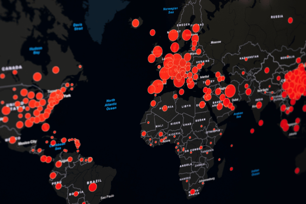
#1. Hotspot Mapping: Locating Disease Outbreaks
What’s a hotspot? In public health, it’s a geographic area where many cases of an infectious disease are concentrated. Hotspot mapping helps health officials use geographical and other data to identify these areas. Armed with this information, they can target their efforts and resources, whether they’re dealing with the flu or another disease.
Public health officials collect data from sources like:
Health departments
Hospitals
Electronic health records
Health information exchanges
These officials then anonymize the data to protect patient privacy and convert address details into map coordinates (a process called geocoding). GIS tools and spatial analysis software use special algorithms to quickly analyze massive quantities of location data.
Public health departments put this technology to work during the COVID-19 pandemic. For example, a specialized GIS-based mapping tool gave St. Louis, Missouri, public health officials a street-level picture of cases based on positive test result data. This helped them identify hotspots and determine patient demographics to better direct their prevention and treatment efforts.
#2. Contact Tracing: Identifying Who’s Been Exposed
After mapping hotspots, officials move to the next critical task: identifying everyone who’s been exposed.
Contact tracingidentifies people who’ve recently been near someone with an infectious disease. After testing positive, the patient lists where they’ve been and who they’ve seen. Health officials then:
Notify those at risk of infection
Provide safety tips to those individuals
Monitor them for symptoms over the disease’s incubation period
Contact tracing debuted in the 1930s during a syphilis outbreak in New York. It was also used, though controversially, during the AIDS epidemic. But traditional contact tracing relied on patients to remember everywhere they went and everyone they saw—and memory isn’t always reliable.
During the COVID-19 pandemic, sophisticated GIS-based tools transformed contact tracing. These location analytics tools use location data to track where infected people traveled and identify others who were in those same places at the same times. This person-to-person-to-place approach lets public health officials notify and advise far more potentially exposed individuals than traditional methods ever could.
#3. Healthcare Planning: Ensuring Equal Access to Care
Identifying outbreaks and tracing contacts is crucial—but what happens if people can’t reach medical care? Where are the hospitals, testing, and vaccination sites? Can everyone access them? Are more needed?
Public health officials must know where all available medical facilities are, especially when an infectious disease is involved. COVID-19, the most consequential infectious disease event in recent memory, showed us why this matters.
ICUs worldwide strained to meet demand during the pandemic. Yet for many, ICU access wasn’t even an option. In response, the Pan American Health Organization (PAHO), part of the World Health Organization (WHO), developed an online hub to share information across multiple countries in the Americas.
Related WHO GIS initiatives helped with vaccine delivery and contact tracing, too. These efforts not only helped health officials respond to emerging health concerns but also strengthened community planning efforts, like providing enough healthcare facilities.
Why GIS Skills Matter for Public Health Careers
Thinking about a career in public health? Here’s the reality: Mastering medicine isn’t enough anymore. Officials need people who can operate the tools that track outbreaks, map resources, and identify at-risk communities. Specialized GIS training ensures you’re prepared to use these powerful tools in real-world situations.
GIS experts have a competitive edge, able to visualize data, identify patterns, and help make decisions that save lives.
Whether you’re analyzing disease spread, planning vaccination sites, or assessing community health needs, GIS training prepares you for real-world public health challenges.
Build Your GIS Expertise With The University of Texas Permian Basin
The University of Texas Permian Basin’s 12-credit online GIS and Geospatial Graduate Certificate is designed for aspiring and current public health professionals. In fully online courses you can complete from anywhere, you’ll learn essential skills like spatial analysis, data visualization, and mapping techniques—all directly applicable to public health work.
Apply now and start building the expertise employers want.
On December 26, 2004, a massive earthquake struck beneath the Indian Ocean and sent a wall of water nearly 100 feet high outward. It barreled into South Asia at 30 miles an hour, wiping out communities before most people even knew what was coming. By the time the waves crossed the ocean, nearly 230,000 lives had…
Imagine you’re commuting to work and your Google Maps loses signal. Suddenly, the little blue dot stops moving and you don’t know where you are. Panic ensues (for some of us). Modern devices constantly broadcast our location through GPS, Wi-Fi, cell towers, and apps. We’re basically walking beacons of sensitive data. But here’s the flip side:…
Flu season is here again, with all its aches, pains, and fevers. But scientists have a powerful tool to fight back. The GPS technology used to plot your rush-hour route home? It also powers GIS (Geosciences Information System) tools that help public health officials pinpoint infectious disease outbreaks, limit their spread, and spot gaps in…
Picture a city where green spaces flourish aboveground, self-driving cars travel underground, pedestrian walkways wind through tree canopies, and waste management operates autonomously. Around the world, cities like Singapore, Oslo, and Charlotte are moving beyond this vision and making smart, sustainable urban design a reality. At the heart of these developments? Geographic Information Systems (GIS).
In this article, we explore how GIS technology is transforming urban planning, from managing resources and reducing environmental impact to engaging communities and planning for long-term sustainability.
How GIS Supports Urban Planning and Smart Cities
As cities aim to improve quality of life while becoming more environmentally conscious, planners are turning to GIS technology. Using GIS in urban planning enables experts to visualize data, assess outcomes, and make strategic decisions that shape the future of our cities.
Below, we explore how GIS supports smarter, more sustainable urban development across a range of focus areas—from risk mitigation and scenario modeling to infrastructure planning and public engagement.
Natural Hazard Risk Assessment with GIS
City planners rely on GIS for natural hazard risk assessment in cities. By identifying areas vulnerable to floods, hurricanes, and earthquakes, they can:
Design evacuation plans
Pinpoint where to build more resilient infrastructure
Prioritize emergency services
Urban Scenario Modeling Using GIS
By using GIS for urban planning, planners simulate the impact of future developments. They can model:
Changes in traffic patterns
Air quality implications
Access to services like schools and healthcare
This kind of predictive modeling helps cities choose sustainable and efficient urban development strategies.
GeoSpatial Analysis for Urban Development
Equipped with GIS technologies, city planners can analyze spatial factors, including:
Land use
Transportation networks
Demographics
Environmental conditions
Infrastructure
By overlaying and analyzing these layers of information, they can identify patterns, trends, and relationships that help them make informed urban planning decisions.
GIS in Urban Resource and Green Space Management
GIS facilitates the efficient management of natural resources in urban areas. City planners can harness GIS for several key functions, including:
Monitoring and assessing the condition of bodies of water, parks, forests, and other green spaces
Nurturing biodiversity
Enhancing the quality of life for residents
GIS in Infrastructure and Transportation Planning
The planning and design of roads, public utilities, and transportation systems is both critical and complex. City planners can use GIS to analyze existing infrastructure, identify inefficiencies, and optimize the location and design of new projects, including:
Analyzing existing infrastructure networks
Determining deficient areas
Optimizing the location and design of new infrastructure projects to maximize efficiency and minimize environmental impact
How GIS Tracks Urban Development Over Time
City planners can use GIS to continuously monitor and evaluate urban development projects. By tracking changes in land use, infrastructure development, and environmental quality over time, these professionals can better evaluate the effectiveness of planning interventions and adjust them when necessary.
Engaging Communities Through GIS Technology
Planners can create interactive maps and platforms that invite public input. Engaging communities through GIS technology means:
Greater transparency
Better alignment with community needs
Increased public trust and participation
Frequently Asked Questions About GIS and Urban Development
Curious about how GIS is transforming urban planning—and what it means for your future career? Explore these common questions for quick insights:
What is GIS in urban planning? GIS (Geographic Information Systems) in urban planning refers to technology used to collect, analyze, and visualize spatial data to inform smarter city development decisions.
How does GIS support smart cities? GIS supports smart cities by enabling real-time data tracking, infrastructure optimization, environmental monitoring, and citizen engagement—helping cities become more sustainable and efficient.
Can GIS be used for climate resilience? Yes. GIS helps identify areas at risk of climate-related hazards like flooding or extreme heat, enabling planners to take preventative action and develop resilient infrastructure.
What careers can GIS certification lead to? A GIS certification can lead to roles in urban planning, environmental consulting, transportation planning, data analysis, and smart city development, among others.
Is the UTPB GIS program fully online? Yes. The University of Texas Permian Basin’s GIS and Geospatial Certificate is offered 100% online in an asynchronous format for maximum flexibility.
Advance Your Career with GIS Expertise
Whether you want to help plan smart cities or have another career in mind, mastering GIS and geospatial technologies can change your career for the better. Expertise in this field is becoming essential for an increasing number of professionals as the technology becomes more widely adopted.
On December 26, 2004, a massive earthquake struck beneath the Indian Ocean and sent a wall of water nearly 100 feet high outward. It barreled into South Asia at 30 miles an hour, wiping out communities before most people even knew what was coming. By the time the waves crossed the ocean, nearly 230,000 lives had…
Imagine you’re commuting to work and your Google Maps loses signal. Suddenly, the little blue dot stops moving and you don’t know where you are. Panic ensues (for some of us). Modern devices constantly broadcast our location through GPS, Wi-Fi, cell towers, and apps. We’re basically walking beacons of sensitive data. But here’s the flip side:…
Flu season is here again, with all its aches, pains, and fevers. But scientists have a powerful tool to fight back. The GPS technology used to plot your rush-hour route home? It also powers GIS (Geosciences Information System) tools that help public health officials pinpoint infectious disease outbreaks, limit their spread, and spot gaps in…
“The application of GIS is limited only by the imagination of those who use it.” – Jack Dangermond, president of Esri
Geographic information systems (GIS) have become indispensable for analyzing and visualizing spatial data. While many of us associate GIS primarily with mapping and GPS (global positioning system), its applications extend far beyond these familiar uses. For instance, GIS plays a crucial role in tracking the spread of diseases and is a valuable resource for law enforcement in criminal investigations.
In this article, we’ll look at ten technologies that you might not realize rely on GIS. Let’s dive in!
Mobile Navigation Many of us use navigation apps like Google Maps or Waze almost daily — and some of us are permanently lost without them! Have you ever wondered how you get those helpful alternative route suggestions mid-commute?
While GPS can locate you anywhere on the planet, these apps also use geospatial systems to provide real-time traffic updates, route optimization, and location-based services. Grateful for all this information at your fingertips? You can thank the integration of satellite data, road networks, and live traffic information. GIS to the rescue!
Smartphones and Tablets Your smartphone is a constant hub of geospatial activity. Beyond just navigation apps, every time you use a location-based service — whether to find a nearby restaurant or track your steps — GIS is hard at work. From Apple’s location-based apps to your favorite social media platforms, GIS provides the real-time data that powers these experiences.
Fitness Trackers Wearable devices made by companies like Fitbit and Garmin have transformed the way we monitor our health. These fitness trackers rely on GIS to map our runs, bike rides, and hikes. By combining GPS with GIS, these devices visualize data such as distance, speed, and elevation in real time, helping you track your progress and adjust your workouts for better results.
Building Information Modeling (BIM) Systems Modern skyscrapers and smart buildings are engineering marvels, and GIS is integral to their design. BIM software like Autodesk Revit incorporates GIS to create detailed digital models of physical structures. This integration allows architects and engineers to optimize designs based on geographic factors like terrain, climate, and environmental conditions — essential for urban planning and the development of future smart cities. As our cities evolve, GIS will play an increasingly critical role in their design and management.
Internet Mapping Technologies Popular mapping software programs like Google Earth, Bing Maps, and ArcGIS Online are only made possible through geospatial technology. GIS integrates and visualizes geographic data online, powering real-time updates, location-based services, and interactive features like zooming, searching, and route planning.
Content Management Systems National Geographic’s journalists and writers often use geospatial technology in their content management tools. ArcGIS StoryMaps, for example, is often used by those who work in media, journalism, or education to create interactive, map-based stories. These systems are used not only to present location-specific content but also to visualize complex datasets, track changes over time, and even integrate real-time data feeds into stories – making the narratives both engaging and informative.
Autonomous Vehicle Systems GIS technology isn’t just for static data. It also powers advanced dynamic systems like autonomous vehicles. Self-driving cars, such as Tesla’s Model S, rely on GIS to navigate and make real-time decisions. By integrating GIS with GPS and sensors, these vehicles can map and contextualize their surroundings, plan routes, and avoid obstacles, ensuring safe and efficient travel.
Drone Technology Drones are popular for both recreational and professional use. What many don’t realize is that drones rely on GIS for navigation, data collection, and mapping. Whether it’s capturing aerial footage or conducting land surveys, geospatial technology helps drones operate accurately and efficiently.
Remote Sensing Remote sensing involves collecting data from satellites or airborne platforms like drones. This imagery is then processed and analyzed using GIS to extract valuable geographic information. GIS is crucial for visualizing environmental changes, such as deforestation or urban sprawl, by comparing satellite images over time. This technology is also essential for monitoring climate change and supporting humanitarian efforts.
Emergency Systems In critical situations, GIS technology can be a lifesaver — literally. Dispatch systems for ambulances and other emergency services use GIS to optimize routes, ensuring that help arrives as quickly as possible. During natural disasters, systems like the Esri Disaster Response Program (DRP) leverage GIS to provide live, continuously updating data, guiding response efforts and saving lives.
Endless Applications for Geospatial Technology
The applications of GIS are vast and expanding, driving innovation across diverse fields. With today’suser-friendly interfacesmarkinga significant evolution from the complex software used by GIS specialists in the past,advanced geospatial analysis is nowaccessible to everyone.
Empower Your Career With Cutting-Edge Expertise
If you’re fascinated by how the modern world uses geospatial technology to improve our daily lives, why not boost your career with The University of Texas Permian Basin’s 12-credit, entirely online GIS and Geospatial Graduate Certificate? UTPB has a decades-long connection to the GIS and geospatial industry and can provide the knowledge and tools you need to integrate GIS into cutting-edge solutions. Best of all, you can study from anywhere in the world — without compromising any commitments.
Geospatial technology is a dynamic field, and GIS analysts are in constant demand. Your expertise can be applied in industries like:
As hurricane season ramps up, people in affected parts of the country and the world are once again thinking about how to prepare for the prospect of a big storm impacting their lives. GIS systems are central to the efforts public officials, first responders, meteorologists, and others make in managing crisis situations, including hurricanes, earthquakes, floods, and wildfires. Here we’ll discuss how they’re harnessing these tools.
Benefits of GIS Applications Before, During, and After Disaster Strikes
Here are some ways GIS is aiding in disaster management:
GIS is used to identify areas at riskfor natural disasters such as floods, earthquakes, hurricanes, and landslides and predict the impact of these disasters on the local population and infrastructure.
GIS enables officials to pinpoint shelter locations, identify ideal evacuation routes, and allocate resources where they are needed most.
GIS technology empowers users to run simulations of potential disaster scenarios to aid in the training of emergency personnel.
GIS helps project potential damage before a disaster, assess the extent of the destruction after it occurs, and prioritize rescue and reconstruction efforts.
GIS collects data from sensors and monitoring systems to providereal-time information on potential hazards, enabling officials to alert the public about developing and imminent dangers.
Long used for map creation, GIS technology is the source of maps and other informative materials officials distribute to show the public where floods are most likely to occur and whether they’re living in an evacuation zone.
GIS enables utility companies to locate service outage areas and prioritize their restoration efforts to those locations.
GIS offers officials a way to reduce the risk of crises and their subsequent damage when such crises may be within human control.
GIS helps officials assess the possible impact of disasters on natural resources, woodlands, and wetlands so they can take steps to mitigate damage.
Map Out Your Own Plan for Greater Career Mobility
A broad range of career fields rely on GIS applications, including government, finance, telecommunications, real estate, healthcare, and insurance. Whether you aspire to move into a field where GIS is used or simply want to expand your resume to qualify for advancement, we have an online program designed to help you.
The University of Texas Permian Basin’s 12-credit online graduate GIS and Geospatial Certificate introduces you to the technology, principles, and practices of GIS through courses that provide valuable hands-on experience with common GIS applications. Build expertise that will benefit you in disaster management and beyond.
Here are some of the reasons you should consider our 100% online GIS graduate certificate program:
Earn your certificate after completing just four eight-week semesters.
Take courses in any order that’s convenient for you.
Access our 100% online, asynchronous courses from any location, 24/7.
Maintain your professional and personal commitments.
The city-state Singapore is building a “forest city” where green spaces are prioritized, pedestrian walkways replace roads, vehicles travel exclusively underground, and trash collection is automated. Oslo, Norway, is borrowing methods refined in the oil industry to install water pipes without digging trenches, preserving the land and minimizing traffic problems and disruptions. Charlotte, North Carolina, worked with Microsoft to create a digital infrastructure that will assist in everything from expanding Wi-Fi access in public places to reducing traffic.
Cities around the globe are going “smart” in increasing numbers. A smart city employs “a suite of sensors … to collect electronic data from and about people and infrastructure so as to improve efficiency and quality of life,” prioritizing energy efficiency and sustainability. Planning and managing these cities understandably requires significant data collection and analysis. Providing the tools and techniques necessary to analyze, visualize, and manage spatial data, geographic information systems (GIS) are playing a central role in urban planning and the creation of smart cities.
GIS: The Modern City Planner’s Best Friend
These are a few of the ways GIS is supporting efforts toward more sustainable and smart cities:
Risk Assessment
GIS helps in assessing and mitigating risks from natural hazards. City planners can use GIS to identify areas prone to floods, hurricanes, and earthquakes; devise evacuation plans; and implement ways to enhance disaster preparedness and promote resilience following such events.
Scenario Planning
City planners are using GIS to create and evaluate scenarios for urban development. They can simulate the potential impacts of different land use policies, transportation systems, and infrastructure investments on factors like traffic congestion, air quality, and access to services. This helps them identify the most sustainable and efficient development strategies.
Spatial Analysis
Equipped with GIS technologies, city planners can analyze spatial factors including land use, transportation networks, demographics, environmental conditions, and infrastructure. By overlaying and analyzing these layers of information, they can identify patterns, trends, and relationships that help them make informed urban planning decisions.
Resource Management
GIS facilitates the efficient management of natural resources in urban areas. City planners can harness GIS to monitor and assess the condition of bodies of water, parks, forests, and other green spaces, nurturing biodiversity and enhancing the quality of life for residents.
Infrastructure Planning
The planning and design of roads, public utilities, and transportation systems is both critical and complex. City planners can use GIS to analyze existing infrastructure networks, determine deficient areas, and optimize the location and design of new infrastructure projects to maximize efficiency and minimize environmental impact.
Monitoring and Evaluation
City planners can use GIS to continuously monitor and evaluate urban development projects. By tracking changes in land use, infrastructure development, and environmental quality over time, these professionals can better evaluate the effectiveness of planning interventions and adjust them when necessary.
Community Involvement
To include the community in the urban planning process, city planners can create interactive maps and online platforms for residents to explore proposed development plans, offer feedback, and even participate in decision-making processes.
Plan for Broader Career Choices
Whether you want to help plan smart cities or have another career in mind, mastering GIS and geospatial technologies can change your career for the better. Expertise in this field is becoming essential for an increasing number of professionals as the technology becomes more widely adopted. The University of Texas Permian Basin empowers you to build that acumen quickly and conveniently with our 12-credit online graduate GIS and Geospatial Certificate program.
Complete just four eight-week courses to earn your certificate.
Learn anytime, anywhere through our 100% online, asynchronous format.
Study under the guidance of UTPB’s distinguished geosciences faculty.
There’s a skill set that’s increasingly applicable throughout the working world today and can translate to greater employability for those who possess it. Businesses, nonprofits, and government entities are using geographic information systems (GIS) to glean an unprecedented level of data and saving lives, time, money, and other resources in ways previously unimaginable in the process. As National Geographic put it: “There is no limit to the kind of information that can be analyzed using GIS technology.”
Here we’ll explore the origins of GIS, its expanding modern-day use, and how to enhance your own GIS expertise.
The First Use of Geographic Information Systems?
A cholera outbreak ravaged 1850s London. At the time, it was widely believed to have been an airborne disease. Dr. John Snow, “the father of epidemiology,” did not accept that theory. Snow did some detective work, mapping areas where cases were most prominent. Eventually, he traced the source to a single water pump, had its use discontinued, and ended the outbreak. Given his methodology, he could be considered a father of GIS.
Fast forward to 1960s Canada. Geographer Roger Tomlinson was asked by the government to inventory the country’s natural resources. He met the request by developing an automated computer system design that combined, stored, and processed the desired data. The true father of GIS, Tomlinson gave the technology its name.
In 1981—the same year the IBM PC hit stores—the GIS world was set on the trajectory that continues to this day with the release of ARC/INFO, the first commercially available GIS. Its creators saw the broad potential of GIS: tools that could and soon would be adapted for use across many fields and industries. GIS had come a long way from its highly specialized beginnings, and its use has only grown in the decades since.
The Many Modern Uses of GIS
Below are just a few of the business and government sectors that today firmly depend upon GIS-derived real-time data for their ongoing operations. GIS use is expected to grow as organizations weigh the downsides of operating without this critical technology.
Natural Resources
True to its origins with Tomlinson in the 1960s, GIS is still used in natural resources, but with far more complex and accurate instrumentation. Modern GIS technology enables public and commercial forestry groups to use maps, images, and remote sensing data on soil, habitat, and canopy to advance forest management efforts. Digital dashboards help forestry professionals work more efficiently while fostering healthier woodlands and more sustainable practices.
Supply Chain
If you can use GIS to inventory Mother Nature’s efforts, you can certainly inventory deodorant, running shoes, vehicles, or any other tangible product. Today, GIS is used to find ideal locations for warehouses and distribution centers as well as the most efficient routes from those facilities to retailers. It can also assess current and historical customer buying patterns to determine where more inventory is or will be needed. For many companies, it’s an all-in-one supply chain management solution.
Climate
Weather events and patterns can have costly consequences. GIS technology helps meteorologists and officials forecast weather issues and identify high-risk areas using data on population, elevation, and other factors. It can also be used to determine ideal evacuation routes and shelter locations, and it proves invaluable in organizing relief efforts and helping officials locate resources, infrastructure, medical facilities, and the like.
Energy Utilities
Once natural gas deposits are found, how can those assets be managed safely and efficiently? This is just one of the crucial energy industry questions that GIS can answer. GIS tools can show precisely where a pipeline should be located for efficient delivery and minimal environmental impact, making the responsible distribution of energy resources possible.
Real Estate
Housing prices and mortgage rates have unquestionably spiked in recent years, and housing inventory in the U.S. is low at present. Choosing sites for building new homes depends on factors including areas where current demand is highest and strong population growth is anticipated. GIS provides localized data that helps developers make informed decisions about planning residential communities, retail spaces, and more.
Government
Perhaps the broadest use of GIS is seen in government, where there are myriad agencies for which the technology is essential.
Law Enforcement
GIS is helping police deliver better preparedness and response results, from establishing safe approach and escape routes during school incidents to pinpointing officer locations during public events. Police radios are subject to interference and can compromise officer positions in sensitive situations.
Elections
How do elections officials ensure adequate polling stations, conduct successful voter registration efforts, offer timely results reporting, and manage other aspects of the election cycle? You guessed it: GIS. If its data, whether demographic or geographic, it can be harnessed and applied via GIS.
Census
The federal government relies on statistics to determine the number of elected officials and resources any locality needs. Our decennial census has traditionally required census takers to go door to door to manually count homes and collect information about their occupants. At one time, this data was collated on punch cards. In 2020, the first solely digital, GIS-driven census—the most accurate national census yet—took place. Aerial and satellite images enabled analysts to quickly identify new homes by comparing recent images to older ones. Other applications allowed them to view demographic information by clicking on a screen, reducing the amount of legwork required.
Apply Your Own New GIS Skills to Just About Any Field
As you’ve seen, GIS is applicable to many fields. Building new skills—or adding to your existing skill set—can be a career booster. Four 8-week courses are all that stand between you and an online GIS and Geospatial Certificate from The University of Texas Permian Basin. In as little as one year, you can reinforce your expertise in the latest GIS and GPS applications, cartography, mapping, and more. And our 100% online asynchronous format will enable you to complete all coursework at your convenience from practically any location. You must have a bachelor’s degree to participate in this graduate program. See full requirements here.
Discover what a GIS and geospatial certificate can do for your career. Apply today!
GIS professionals are no longer limited to mapping and land surveys. Today, industries like healthcare, finance, and even retail rely on geospatial data to drive decisions. If you’re curious about where your GIS skills can take you (or wondering what industry GIS belongs to), we’re exploring six sectors that use GIS and the types of roles you’ll find in various industries.
#1 GIS in Education: Teaching Data Literacy
Teachers in many disciplines can use maps and location analytics to illustrate patterns and connections to their students. This strengthens their ability to make data-based conclusions about human-made and natural systems.
#2 How Financial Institutions Use GIS
Banks and other financial institutions can use spatial analysis to identify customers likely to help their business grow. This allows them to identify common characteristics among these individuals and seek new customers with similar traits in other geographic areas.
#3 GIS in Healthcare: Mapping Public Health Trends
GIS technology proved invaluable during the COVID-19 pandemic, allowing officials to track case rates and analyze data on mortality, hospitalization, and recovery. Today, healthcare professionals use GIS to identify disease hotspots and high-risk areas, helping to target prevention and treatment efforts more effectively.
#4 GIS in Insurance: Assessing Risk by Location
Is your home likely to be hit by a hurricane? Is your car likely to be stolen? (Or damaged by a hurricane, for that matter?) Are there high rates of certain diseases in your area of the country? Insurance companies of all types can look at data collected through GIS-driven analytical tools to decide if you are insurable, and if so, what your premiums are going to be.
#5 Retail Industry GIS Applications: Finding the Right Location
From high-end clothing stores to fast food restaurants, retail businesses use GIS to determine where to open new brick-and-mortar locations. The technology helps identify information such as proximity of potential customers and local saturation of competing businesses.
Potential business owners can also use these tools to find out what consumers in these areas want to wear, eat, etc. to ensure that they meet the demand through proper inventory management.
#6 Telecommunications and GIS: Planning and Expansion
Telecommunications companies can use GIS to locate and gauge the extent of service outages. It helps them plan ahead for the expansion of services required by population growth and new construction.
Careers for GIS and Geospatial Professionals
As GIS and geospatial technologies expand into new industries, so do the career opportunities for skilled professionals. Whether you’re entering the field or looking to advance your career, here are just a few of the roles available across industries using GIS:
Location analyst: Evaluate optimal store or facility locations using demographic and spatial data. (Retail, real estate)
Health geographer: Track and analyze disease patterns to support public health efforts. (Healthcare, government)
Risk analyst: Assess environmental and crime-related risks for insurance underwriting. (Insurance)
Market research analyst: Use spatial data to understand consumer behavior and identify target audiences. (Financial institutions, digital marketing)
GIS technician/analyst: Create and manage geospatial databases and maps for a range of organizations. (Telecommunications, urban planning, education)
Remote sensing specialist: Analyze satellite or aerial imagery to support environmental monitoring or infrastructure planning. (Environmental science, agriculture, oil and gas/energy)
Data visualization specialist: Turn complex GIS data into clear, actionable visual insights for stakeholders. (Public health and epidemiology, finance, insurance)
Update Your GIS/Geospatial Experience and Credentials in Less Than a Year
Drawing from the decades-long relationship between The University of Texas Permian Basin and the GIS and geospatial industries, our online graduate GIS and Geospatial Certificate program helps you stay up to date with the latest GIS systems that are vital across various industries. And because we understand the challenge that can come with balancing a work-life schedule, our program allows you to arrange your studies around your professional and personal commitments (while adding a new credential and practical expertise to your resume).
Here are a few more reasons to consider earning our GIS and Geospatial Certificate:
On December 26, 2004, a massive earthquake struck beneath the Indian Ocean and sent a wall of water nearly 100 feet high outward. It barreled into South Asia at 30 miles an hour, wiping out communities before most people even knew what was coming. By the time the waves crossed the ocean, nearly 230,000 lives had…
Imagine you’re commuting to work and your Google Maps loses signal. Suddenly, the little blue dot stops moving and you don’t know where you are. Panic ensues (for some of us). Modern devices constantly broadcast our location through GPS, Wi-Fi, cell towers, and apps. We’re basically walking beacons of sensitive data. But here’s the flip side:…
Flu season is here again, with all its aches, pains, and fevers. But scientists have a powerful tool to fight back. The GPS technology used to plot your rush-hour route home? It also powers GIS (Geosciences Information System) tools that help public health officials pinpoint infectious disease outbreaks, limit their spread, and spot gaps in…
Have you ever wondered how meteorologists predict the path of that soon-to-be Category 5 hurricane that’s lurking out in the ocean? For people who live on coastlines, familiar models like forecast cones and spaghetti models that show a storm’s projected path offer the integral information needed to prepare for a life-saving evacuation.
How We Track Hurricanes
Bringing historic flooding, record-breaking wind speeds, and storm surges that devastate communities, hurricanes make destructive impacts to our coastlines and have been increasing in intensity and frequency in the 21st century. Understanding how these powerful cyclones form and behave is critical to saving lives.
Scientists at the National Hurricane Center and other agencies follow a series of procedures to track a developing storm system using sophisticated tracking tools. This information is sent to Weather Forecast Offices, who then relay the information to the public.
Prior to the development of advanced storm tracking technology, however, forecasters relied on communications from boats at sea and from watching pressure changes on barometers. These forecasting methods were unreliable and often unable to prevent devastation.
The Galveston Hurricane of 1900 claimed up to 12,000 lives and is considered one of the deadliest disasters in U.S. history. The town’s decimation marked a turning point in hurricane tracking and forecasting. As a result, advancements were made in meteorological technologies, such as telegraph communication to transmit weather data, establishing hurricane observation stations, and developing detailed hurricane tracking charts.
Meteorologists today use many sophisticated methods and tools to predict and manage hurricanes, such as:
Weather satellites
Computer models
Doppler radar
Observation stations
Reconnaissance aircraft/hurricane hunters
Ocean buoy networks
Weather balloons
GIS-based models
What Is GIS?
Most of us use GIS each day and don’t even realize it. That map or navigational app you use on your phone for directions and when searching for a nearby store, landmark, or gas station? It operates with the support of GIS technology.
GIS is short for geographic information system. It refers to a computer system that stores and interprets spatial data and technology from a specific geographic location. Geographic information systems are used in numerous industries, like urban planning, environmental management, public health, transportation networks, natural resources, and climatology.
Meteorologists, researchers, and emergency managers use GIS-based models to visualize and integrate data from sources like satellite imagery and topographical maps into a geographical framework. The framework is used to predict and manage hurricanes more effectively. This technology also makes real-time weather and storm tracking apps possible.
How Is GIS Applied When Tracking Hurricanes?
Data visualization and integration GIS integrates data sources like satellite imagery, radar data, weather station observations, and topographic and oceanographic data.
Models and forecasts GIS-based models use historical storm data, atmospheric conditions, and geography to help predict storm paths, storm intensity, and impacts. These predictions help meteorologists create early warning systems and aid in decision-making and hurricane preparedness.
Evacuation planning GIS allows for the identification of proper evacuation and routing zones based on a storm’s projected path, transportation networks, and the affected region’s topography.
Real-time data for public use Real-time weather is presented in the form of interactive maps, such as the National Ocean Service’s nowCOAST web portal, and in any real-time map you use when tracking the movement and intensity of a storm. Many hurricane tracking apps also include evacuation zones and routes, shelters, and other details powered by GIS technology.
Potential impacts GIS-based models help predict the potential impacts to areas at risk, including vulnerable populations, affected infrastructure, and potential economic loss.
Damage assessment After a storm, officials use GIS-based models to assess damage in the affected region, which helps organize response and recovery efforts.
Explore the Dynamic World of Geospatial Technology
The University of Texas Permian Basin has been involved in the GIS and geospatial industry for over two decades, empowering us to develop a program curriculum with an in-depth industry perspective. Our 12-credit online GIS and Geospatial Graduate Certificate program dives into the wide-ranging applications of geoscience information systems and geospatial technology. You’ll master geoscience tools like GPS, mapping, and cartography and attain knowledge that’s applicable to a wide range of careers including:
Meteorologist
Geographer
Energy and petroleum professional
Environmental analyst
Real estate developer
Epidemiologist
Natural resource manager
Cartographer
GIS is also commonly used by retail businesses, marketing companies and engineering companies and applied in scientific and criminal investigations, giving you an astonishing array of career options.
The knowledge you’ll gain with our online GIS and geospatial graduate certificate is also applicable to critical real-life challenges, such as understanding the logistics of transportation, familiarity with regional geography in the event of a disaster, and even how to track hurricanes. With climate change causing more frequent and intense storms in many of our regions, understanding the process of how we track severe weather is essential.
Embark on a journey of discovery and earn a unique geoscience credential that will set you apart in any industry! Classes are entirely online and asynchronous and can be completed on your own time. There are no prerequisite courses required. Apply here!